
Collection Facts
Historical Context
Background on the Holland Land Company in Western New York Before the arrival of the first settlers, the area of western New York State, known as "Genesee Country," was the home of the Seneca Indians. Robert Morris of Massachusetts purchased Genesee Country in 1791 and sold it to the Holland Company, a group of Dutch bankers, on July 20, 1793. The Holland Company opened for business in 1800; the first land sale was in 1801; and the company moved the office to Batavia when Genesee County was founded in 1802. The beginnings of the Holland Land Company date back to 1789, when four Amsterdam firms, P. Stadnitski, N & J van Staphorst & Hubbard, P & C van Eaghen & Ten Cate, and Vollenhoven together sent an agent to the United States to keep them informed of financial developments and to invest money in the new country. Van Staphorst and Willink were two Dutch firms that had made loans to the United States government during the American Revolutionary War. The "Club of Four," as it was called, invested in different funds such as the South Carolina Funded Debt, the Massachusetts Deposit, and the Pennsylvania Population Company. The group also invested in canal construction companies in 1791 and 1792.
The agent sent to keep the Dutch investors informed was Theophile Cazenove. Cazenove arrived in the United States in 1790 and settled in Philadelphia where he entertained and met with many influential people in American business and politics. In August 1791 Cazenove advised the Club of Four to begin buying land in the wilds of America. The van Staphorst firm was reluctant at first but joined in the venture after the other three firms began to buy land. The Dutch banking firms of W. Willink and RJ Schimmelpennick began to cooperate with the other four banking houses in September 1792, creating the "Club of Six." Three months later, Cazenove bought 1.5 million acres in tracts 4 and 5 of the Genesee Lands from Robert Morris, Sr. At the same time, the Club of Six bought another 1 million acres in tract 2 from Robert Morris, Jr., and obtained an option for another 800,000 acres, which they later bought. They also purchased 700,000 acres east of the Allegheny River in Pennsylvania and about 77,000 acres in Central New York. Some of the firms wanted to sell the lands quickly to speculators while others preferred to wait for a better opportunity.
In order to create a market, the firms decided to merge their holdings into one stock company, and on November 20, 1795, the Holland Land Company was formed. Before the survey could begin, financier Robert Morris had to clear the land title from the Seneca Indians. In late August 1797, representatives from the American government and Robert Morris arrived at Big Tree, just outside the present Village of Geneseo in Livingston County. The negotiations began on August 28, 1797. Joseph Ellicott, a respected surveyor, was invited because he knew the territory from his travels through the area to Upper Canada eight years earlier, and he had a friendship with several Indian chiefs. There were three parties involved in the negotiations: Robert Morris, the Seneca Indians, and the United States government. Representing Morris was his son, Thomas. Over 1,000 Senecas were present, led by Red Jacket, Farmer’s Brother, and Cornplanter. Jeremiah Wadsworth represented the federal government. The Holland Land Company sent a team of six men as observers. Their orders from Philadelphia were to stand on the sidelines and not be publicly involved. Paolo Busti, the new General Agent for the Holland Land Company (replacing Cazenove in 1796) was also present. Discussions seemed to stall and at one point, Red Jacket, Farmer’s Brother, and Cornplanter refused to sign the treaty. Morris then tried a new tactic. He promised Seneca women 60 cows and gave annuities to some of the chiefs. Red Jacket received $600; Cornplanter received $300; Farmer’s Brother and Billy received $100 each; and Little Beard received $50. The Treaty at Big Tree ended a little more than two weeks after it began. The Senecas retained a little less than 200,000 acres and received $100,000 of the Bank of the United States stock with the dividends paid semi-annually. With the signing of the Treaty of Big Tree, Morris transferred the title to 3.3 million acres of land in western New York to the Holland Land Company.
Theophilus Cazenove, the Agent-General of the Holland Land Company, hired Joseph Ellicott as Chief Surveyor in July 1797. Ellicott's experience included surveying the company's land in northwestern Pennsylvania. After extinguishing the Seneca Indians' claim to the land at Big Tree, Ellicott's objectives for the survey were to lay out the 3.3 million acres of company land, arrange the specific boundaries for the Seneca Indian Reservations and subdivide all the towns into six square miles. The surveyors were also required to complete field books describing the land, waters, mill seats, valleys, mines, minerals, and any other information that could be useful for the Company when selling the land. One of the first obstacles Ellicott faced was his concern for accuracy as the United States lacked a standard of measurement. Ellicott solved this by collecting a number of rulers, determining the average, and designating that as the figure for a one-foot length. Ellicott became the first person to use the one-foot ruler that we use today. The second obstacle was the need for a portable transit instrument. Andrew Ellicott, Joseph's older brother, was using the only one in the country in Florida where he was surveying the boundary between the United States and Spanish lands. The instrument was used to observe the transits of heavenly bodies, essential for working in the deep woods where a compass would not be as accurate. Joseph had his mechanically inclined younger brother, Benjamin, build a new transit instrument for use in western New York. The survey that started in March 1798 ended October 1800 and cost the Holland Land Company over $70,000. Today, this transit can be seen on display at the Holland Land Office Museum in Batavia, NY. Principal surveyors in the first season included: Joseph Ellicott (Chief Surveyor), Benjamin Ellicott, John Thompson, Richard M. Stoddard, George Burgess, James Dewey, David Ellicott, Aaron Oakford, Jr., Augustus Porter, Seth Pease, James Smeadly, William Shepard,, and George Eggleston. Ellicott’s carefully organized report included notes from the field describing the quality of the land, including types of trees (sugar maple, beech, oak, ash, and elm trees were abundant), potential sites of towns and suitability of the soil for raising corn, wheat, rye, and other grains. The report also identified different types of wildlife within the terrain, including rattlesnakes, bears, wolves, elk, foxes, deer, minks, otters, and other animals.
With the Great Survey finished, the next step in settling the vast tract of land was to find an agent with the planning and organizational skills to turn the wilderness into a new frontier. The Holland Land Company considered several candidates before appointing Joseph Ellicott, who remained in his position until 1821 (the last agent for the Company was appointed in 1837). Paolo Busti, Agent-General of the Holland Land Company, and Joseph Ellicott signed the contract on November 1, 1800, in Philadelphia. For the next 20 years, Ellicott held the post of Resident-Agent in charge of land sales on the Holland Purchase. In order to expedite the sales of land in this vast parcel, several subagents were appointed in various areas. In the southern tier, subagents included William Seward (future Secretary of State under Abraham Lincoln) and N. Deveraux; in Buffalo there was subagent L.A. Blossom; and in the Niagara Orleans Genesee area, LeRoy en Redfield Ellicott set up the first land office in the tavern of Asa Ransom in Clarence Hollow in 1801. A year later, he moved it permanently to Batavia.
Through Ellicott's influence, the Holland Land Company implemented programs to encourage settlement by giving loans to settlers to build mills on the Purchase. The Company also gave land to the first two blacksmiths in the area. The Company loaned $3,000 to assist the establishment of the first general store in Batavia and offered free land to anyone who would open inns at 10-mile intervals along the newly opened roads. The Company also donated money and land to establish churches and schools. The Holland Land Company sold land to individual settlers by an Article of Agreement, and the settlers received the deed upon full payment. The plan started to change in 1802, when Genesee County was formed. New York State law required county officers and voters to be landowners, and Ellicott estimated there were fewer than 30 landowners in the entire county, making it almost impossible to gather enough people for the positions available or to summon a jury. Ellicott changed the policy by giving a settler the deed when 25% of the purchase price was paid. Ellicott and Busti differed on the payment policies. Ellicott thought the way to populate the Purchase was with liberal credit terms that would give the settlers 10 to 12 years to pay. He believed that selling land to poor, landless families would encourage them to work hard clearing and developing the land. In Ellicott's view, western New York would cease to be the frontier, and land values throughout the Purchase would increase. The Erie Canal also helped move people into the lands owned by the Holland Land Company. Although he personally doubted the canal project would ever be completed, Ellicott publicly praised the idea of the Erie Canal because it would greatly increase the value of land, at little expense to the company. He estimated it would raise land values near the canal from $3 per acre to over $20. He also thought the canal would allow settlers to transport goods to market at less than half the current cost. Busti and Ellicott discussed the terms of an offer to the State of New York and finally the Holland Land Company donated 100,632 acres of land in the southern part of the purchase. The conditions for the donation stipulated that the state would pay tax on the land and return it to the Company if the canal was not built within 15 years. On November 27, 1813, the Canal Commission accepted the offer, and the project was one step closer to becoming a reality. The Erie Canal was finally completed in 1825 (from: The Great Survey, 1798-1800 and The Life and Times of Joseph Ellicott, both by Patrick Weissend).
The original county encompassing the area of the Holland Purchase was Genesee, named for the Seneca word meaning "beautiful valley." Genesee County was initially divided into only four "Shires" or towns: Batavia, Northampton, Southampton, and Leicester. Gradually, parcels of land were taken from Genesee County to form other counties: Allegany (1806), Cattaraugus (1808), Chautauqua (1808), Niagara (1808), part of Livingston (1821), part of Monroe (1821), Erie (1821), Orleans (1824), and Wyoming (1841). What was left is the present Genesee County (from: Genesee County History, by Betty Thomas). Related Resources Below are several sites that have additional background information, as well as lesson plans for teachers relating generally to land surveying in American History and specifically to the Holland Land Purchase and Survey in western New York:
Joseph Ellicott (1760-1826) Andrew Ellicott (1754-1820) The Holland Land Purchase Joseph Ellicott (1760-1826)The Holland Land Purchase and Holland Land Company RecordsThe Holland Land Company and Joseph EllicottTraces of the Holland Land Company Survey of New York StateHow Simeon DeWitt Mapped New York State (NY Map Society article)19th century Monographs on the History of Western New YorkEarly American Surveyors: Mapping the Wilderness (Professional Surveyor Magazine)Virtual Museum of SurveyingThe Public Land Survey SystemHistoric USGS Maps of New YorkLand Ordinance of 1785 (excerpts)Teacher Guide — For Land's Sake: George Washington as Land Surveyor Lewis & Clark: Discovering, Mapping the West Mapping on the TrailAndrew Ellicott (1754-1820)The Lewis and Clark Expedition and the USGS (lesson plan)
Scope of Collection
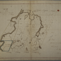
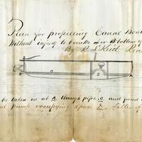
The collection is comprised of scanned microfiche images of maps. The maps date from the late 18th century to early 19th century. Most of the maps depict the Western New York, Northwestern Pennsylvania, and Eastern Seaboard regions. Some of the maps represent lot holdings, lot plans, Native American reservations, and city streets.
Browse within this collection
Additional Information
Browse similar collections

Collection Facts
Historical Context
The records comprising the Archives of the Holland Land Company, an early 19th-century Dutch conglomerate of six Dutch banking houses, document an essential component of Western New York history and represent a critical resource for scholarship within a variety of disciplines. These include history, geography, political science and economics, alongside considerable material for research on a more local or regional level by members of the general community and genealogists. As primary source documents, the records provide a unique insight into land speculation and land use development for the period of 1789 to 1869, from both foreign and domestic perspectives. The records also serve to highlight the crucial role performed by the Holland Land Company in the history of the United States in general and New York State in particular. The materials include investment records, land purchase negotiations, land surveys, financial records, land sales ledgers with contracts and payments, deeds, warrants, patents and tax assessments. Also included are court records and related papers and considerable correspondence between land owners, agents, bankers and the settlers who purchased the land. A significant portion of the materials are in English, though some correspondence is written in either French or Dutch.
While the original manuscript materials that comprise this digital collection are held by the Gemeentelijke Archiefdienst van Amsterdam (Municipal Archives of Amsterdam) in The Netherlands, the Daniel A. Reed Library of The State University of New York at Fredonia holds the entire extent of the collection in microfilm format (202 reels). The microfilm is a result of a project undertaken several decades ago by former Reed librarian, Franciska Safran. Through the generous support of a Regional Bibliographic Database Initiative (RBDB) grant from the Western New York Library Resources Council, 20 reels from this collection are now available in digital format. It is hoped that the remainder of the collection (182 reels) will eventually be digitized and made available on New York Heritage as funding is obtained. Previous digitization efforts funded by 2007 and 2008 RBDB grants focused solely on the digitization of nearly 1400 maps (from color microfiche) found in the Holland Land Company archives. Many of these maps are also found in the present digital collection, though with the added benefit of context, in that they appear alongside other documents according to the original order of the document groupings held at the Municipal Archives of Amsterdam.
As the collection is rather extensive, researchers are encouraged to first consult the Inventory of the Archives of the Holland Land Company 1789-1869 (Municipal Archives of Amsterdam, 1976) by Dr. Wilhelmina C. Pieterse, former Head Archivist of the Municipal Archives of Amsterdam. Dr. Pieterse’s guide provides a detailed description of materials, as well as numbers for the corresponding microfilm reel on which the materials (arranged by document groupings) appear. This information is critical to navigating the digital collection, as the materials were digitized in groupings to reflect this guide. Specifically, the title and description for each document grouping is based on how it appears in the Inventory. For example, the materials found in document group 786 may be found by searching the Title field for the text string “document group 786”. Additionally, the identifier for each digital grouping is based on the reel number and document group for the physical materials, again reflected in the Inventory. For example, the document grouping 786 is found on reel 175. Thus, the identifier for those materials appears as: XFM003_HLCr175_v786, wherein “r” denotes the reel and “v” denotes the document grouping. Alternatively, researchers may simply browse materials by using the pull-down menus on the left.
The Daniel A. Reed Library Archives & Special Collections of The State University of New York at Fredonia remains grateful to the Gemeentelijke Archiefdienst van Amsterdam (Municipal Archives of Amsterdam) and the Nederlandse Document Reproductie B.V. for their collaborative roles in the original microfilming project of the Holland Land Company Archives.
Scope of Collection
A collection of 20 digitized reels of microfilmed primary source materials relating to the history and early years of the Holland Land Company, with a focus on materials detailing the history and development of Western New York. The original materials are held by the Gemeentelijke Archiefdienst van Amsterdam (Municipal Archives of Amsterdam) and were microfilmed as a part of the Holland Land Company Project.
Browse within this collection
Browse similar collections

Collection Facts
Historical Context
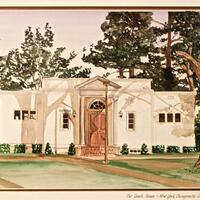
Hofstra University, founded in 1935, was named after William Sake Hofstra and Kate Mason Hofstra. Research has traced the Hofstra’s history back to 1830 in the Province of Friesland in The Netherlands.
Scope of Collection
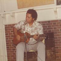
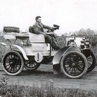
This collection contains various photographs ranging from 1904-32 from the Hofstra estate in Hempstead, New York.
Browse within this collection
Browse similar collections


Collection Facts
Historical Context
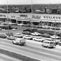
Hofstra University is a private, non-profit, nonsectarian institution of higher learning. Its main campus is located in the village of Hempstead, New York. It originated in 1935 as an extension of New York University (NYU) called "Nassau College – Hofstra Memorial of New York University at Hempstead, Long Island"; in 1939, the institution separated from NYU and gained independence as Hofstra College, and in 1963, Hofstra College gained university status.
Scope of Collection
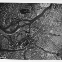
The Hofstra Buildings Collection consists of historic photographs of buildings on campus and include aerial views.
Browse within this collection
Browse similar collections


Collection Facts
Historical Context
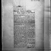
Waterville is a village in Oneida County, New York officially formed in 1808. The town of Sangerfield is south of Waterville, also in Oneida County, was established in 1795 and named after Revolutionary War soldier Col. Jedediah Sanger. The region was originally settled by the Iroquois or Haudenosaunee Indians, in particular the Oneida tribe. During late 19th century, Waterville and the surrounding area was known as the "Hops Capital of the World" for growing large quantities of hops, which are a primary ingredient in the brewing of beer. Following Prohibition and the Great Depression, hop production became less prominent and the region shifted to other forms of agriculture.
The Waterville High School in use during the time the Academic Union yearbook was published was built in a Gothic Style between the years 1909-1912. Two large additions were built in the 1930s to accommodate a growing student body.
Scope of Collection
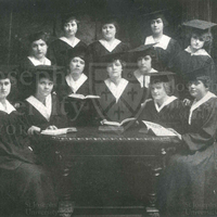
The documents detail the history of the region and early settlers, including their relationship with the Oneida. Topics include early politicians; schools; building of roads; Oneida settlement patterns and artifacts; local industries such as earthenware milk pans and bricks; distilleries; the history of hops production; inventions developed by locals such as the Trask bark mill, Harris paint mill, and Harris hops lever press; and geological features of the area.
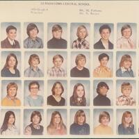
The collection includes yearbooks from the Waterville High School, dated from 1915 - 1919. Also included are historical accounts of the town of Sangerfield, written in the mid to late nineteenth century and transcribed in the late twentieth century.
Browse within this collection
Browse similar collections

Collection Facts
Historical Context
Crouse Hospital has had a profound impact on the health of Central New Yorkers since its inception in 1887. Originally incorporated as a hospital specializing in women’s and children’s health, Crouse has been integral in improving public health in Syracuse. The tuberculosis epidemic in the late 19th and early 20th Centuries hit Syracuse particularly hard, and was a defining moment in the history of the hospital and in fighting tuberculosis. The Crouse Hospital Library Archives contains the records of Crouse-Irving Hospital, Syracuse Memorial Hospital their precursors and affiliated Schools of Nursing. This project curated by Alison Churchill in 2017 in fulfillment of requirements of a Masters in Public Health from SUNY Albany provides an opportunity to share Crouse’s public health history with particular emphasis on tuberculosis within the Central New York community, increase access of our tuberculosis-related materials, inform the public of Crouse Hospital’s historical impact on public health, and to make this era of public health history easily accessible for future researchers.
Scope of Collection
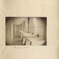
This collection contains original material from the archival record series representing Crouse-Irving Hospital Bulletin and Annual Reports from Syracuse Hospital for Women & Children and Syracuse Memorial Hospital. Documents include writings of practicing physicians including William L. Wallace and Carl E. Muench founders of Crouse-Irving Hospital, surgical volume statistics, disease reporting, and advertisements from 1889-1924.
Browse within this collection
Browse similar collections

Collection Facts
Historical Context
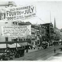
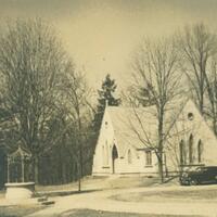
The Village of Lakewood rests on the shores of Chautauqua Lake in southwestern New York where "its pure, deep, clear water comes almost entirely from underground springs...and the atmosphere possess a freshness and a braciness born of contact with the undulating waves of the cool waters of the lake" (Source: The Kent and cottages ... the Waldmere and cottages, Lakewood, N.Y., n Lake Chautauqua, 1897)
This primarily pictorial collection of 67 items explores the development of the village from a small farming community to a renowned health and leisure resort and looks at the more intimate side of the town. The collection brings together images and information about the glamorous people and places of Lakewood, as well as the everyday charm of its citizens, schoolchildren, local eccentrics, benefactors, and heroes.
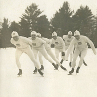
The late 1870s saw the beginning of Lakewood's blossoming when lakeside cottages and summer homes were constructed near Sterlingworth Hotel by its owners. Throughout the late 19th century and the early 20th century, Lakewood's train station brought vacationers to the fashionable resorts, hotels, and summer homes of Lakewood. The civil side of Lakewood also saw growth and development during these years. Highland Avenue School was constructed in 1893. The small schoolhouse maintained classes for students from primary through high school. A brand new high school was then constructed in 1924. Citizens also enjoyed recreational activities such as skating in the winter and parades in the summer.
This collection highlights Lakewood's summer resorts and hotels; class photographs from as early as 1900, covering grade school through high school; as well as photographic and textual selections from various school publications, recreational activities, and the fire department. It also includes images relating to the Packards and the Sorgs, two famous and wealthy families of Lakewood whose legacies left an indelible impact still seen today.
By digitizing these items, the recently established Lakewood Historical Museum hopes to showcase how influential their small village is in the history of Western New York. Their hope is that through their collections, residents and future residents will always have tangible records of their beloved community. Lakewood residents old and new are learning firsthand how wonderful it is to be part of an established historic community.
For more information on both the history and the current vitality of Lakewood, take some time to visit Welcome to Lakewood, NY or Lakewood, NY - History.
Scope of Collection
The collection includes many photographs, primarily from the early 20th century. There are also some booklets and related ephemera. Many of the photographs are class pictures from Highland Avenue School. There are also photographs of notable residents and area landmarks.
Browse similar collections

Collection Facts
Historical Context
A History of the Town of Amherst, New York, 1818-1965 (306 p.), was published by the Town of Amherst in 1965 and written by the Town Clerk and Town Historian, Sue Miller Young. A descendent of some of Amherst's oldest families, Mrs. Young was one of the founding members of the Williamsville Historical Society and an accomplished archer. Sue Miller Young also wrote a highly informative column for the Amherst Bee on the history of Amherst. These articles are indexed at the Niederlander Research Library and Archives at the Buffalo Niagara Heritage Village & Museum at Amherst.
This book, the first book-length definitive history of the Town of Amherst, has been out of print for quite some time and is therefore in frequent demand by local historians and genealogists. Another book on the history of the Town of Amherst was published more recently in 2000 (Glancing Back: A Pictorial History of Amherst, New York, by Dr. Joseph A. Grande). The Young publication is essentially a chronological narrative of the area, beginning with a very brief introduction of pre-European geography and settlement, the influence of the Holland Land Company on European settlement, the origins of the town's name and a description of events and people in the first half of the 19th century until the Town's incorporation in 1850.
From that point on, the book relates the historical development of several hamlets within the boundaries of the Town of Amherst, including the schools, churches, government offices, and businesses that were established in each. Concluding chapters include overviews of topical subjects as they relate to the history of the Town of Amherst as a whole, including transportation, entertainment, newspapers, and military conflicts from the Civil War to the Korean Conflict. The book ends with a look at Amherst in the 1960s (the decade of the book's publication) and a chronological listing of town history. There is an index, but the book lacks any notes listing primary or secondary materials that identify sources of various citations and images used throughout.
The Buffalo Niagara Heritage Village's permanent exhibit, "From Forest to Front Lawn," is an excellent visual complement to A History of the Town of Amherst. "From Forest to Front Lawn" explores the history of the town from the 1800s to the present. In 2,500 square feet of the Buffalo Niagara Heritage Village museum's main exhibition area, visitors can see how the town has developed from a thickly forested area to an agricultural town and finally to the active suburb it is today. Some key highlights of the exhibit are a recreated facade of the Centre House tavern, a 1950s Nash Metropolitan Convertible, and a portion of a recreated Jimmy's Diner with interactive exhibits for kids. The exhibit goes beyond the end point of Young's book, looking at the development of Amherst into the 21st century, paying particular attention to the environmental and economic challenges taking place today.
Soon to be added are two additions to the exhibit including a section on Native Americans who were in the area before European settlement and a history of the Police and Fire Departments in the Town of Amherst. In addition, the Museum at Amherst has an education program with presentations, live demonstrations and other activities that bring a visual sense of understanding to the history related in Sue Miller Young's book.
The Town of Amherst was established, along with many other towns in the area, as a result of the westward migration of people from New England who had either purchased land from the Holland Land Company or were on their way further west via the Great Lakes. The path of movement lay along a route that had been well established long before Europeans were on the continent. Before this time the roads were mostly narrow Indian trails like the "Great Iroquois Trail," which crossed New York State from Albany to Lake Erie. Joseph Ellicott hired men to improve the trail between Batavia and Buffalo so settlers could travel to Western New York more easily. This improved road was first called the Buffalo Road. It is now called Main Street. The Town of Amherst, and specifically the Village of Williamsville, lay directly in the path of this main road. In the earliest days, Ellicott encouraged people to buy land along this main route with the purpose of opening a tavern to accommodate the streams of settlers on their way west.
The War of 1812 brought an increase in activity and settlement as American and British soldiers engaged in conflict in the surrounding area. The opening of the Erie Canal in 1825 also brought a significant increase in commerce and settlement to Amherst as part of the Canal passed along the northern edge of the town. Many German settlers in particular came to the area as farmers attracted to the open, fertile lands in North Amherst. The water resources of the area provided not only a source of transport for moving people and goods, but also a source of energy for commerce. Grist mills, saw mills, and several other types of factories populated the area along Ellicott Creek.
During the period around the two World Wars there was a massive migration of African Americans into urban areas, including Buffalo, NY. Segregation and discrimination were still strong attitudes and practices in white communities, so many African Americans and other minorities were forced to live in isolated and poor areas of the city as well as work for the lowest wages. Poverty and crime became associated with these minority groups and therefore the suburbs became a way to avoid contact with the new populations coming into the cities. The invention of the automobile, along with statewide road improvements, encouraged more people living in the city of Buffalo to move out to the less congested and "safer" suburban areas, including Amherst. The movement to the suburbs was further compounded by the boost in consumerism following WWII. Open farm land parcels were rapidly bought up by developers and transformed into substantial housing developments. New and expanding businesses also established themselves in Amherst, bolstering economic growth and subsequently allowing the municipal government to provide the best amenities for its citizens, including parks, recreation, fire, police, and library services. The decision of the University at Buffalo to locate one of its campuses in the town of Amherst has also had a significant and lasting impact on the character of the town.
Moving into the 21st century, the town of Amherst faces several new challenges and opportunities. The metropolitan Buffalo area continues to lose population at a significant rate. This has had an impact on the economic and social fabric of Amherst as well as other surrounding suburbs. Opportunities for new growth continue as Amherst communities and businesses continue to advance in education and technology sectors.
Additional Resources
America's Infrastructure: Miller Center National Discussion and Debate Series (PBS: lesson plan for grades 7-12)
Amherst Bee
Buffalo & Erie County Public Library - Audubon Branch (Amherst's library)
Library of Congress (search "Amherst, New York")
New York State Historical Association Research Library (information on American town life)
New York State Historical Association Research Library (information on Amherst, NY)
"Plot Development, or E. F. Beadle's Adventures in Building Suburban Homes in Late Nineteenth-Century New York," by Katherine E. Chaison
Postwar Suburbanization: Homogenization or the American Dream? (University of Maryland Baltimore County's Center for History Education: lesson plan for high school)
Town of Amherst
Village of Williamsville
Scope of Collection
The collection consists of the book, A History of the Town of Amherst, New York, 1818-1965, by Sue Miller Young, published in 1965.
Browse within this collection
Browse similar collections

Collection Facts
Scope of Collection
This collection documents the early history of the Moffat Library and contains construction estimates, early images and invitations to library programs from the late 19th and early 20th centuries.
Browse within this collection
Browse similar collections


Collection Facts
Historical Context
The history of Crandall Public Library dates back to 1892 when Henry Crandall provided funds for books and a place to keep them, and insisted on free books and services for "anybody who has interest enough in reading." The Crandall Trust, established after his death some 20 years later, keeps his vision alive. Today, as central reference library for 4 counties, Crandall Public Library serves over 1500 visitors daily.
Scope of Collection
This collection contains images of Crandall Public Library and portraits of people associated with the library.