1935 Federal Improvement Aerial Survey

Collection Owner:
Cover Image:
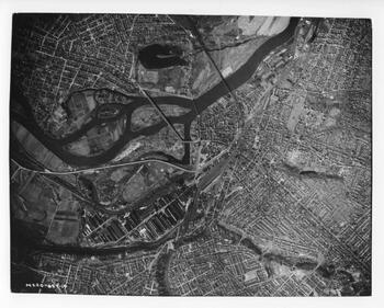
1935 Federal Improvement Aerial Survey
100.1722.031 (M220-857-14), 1935 Federal Improvement aerial survey of the Barge Canal - Image Source

Collection Facts

Extent:
237
Dates of Original:
1935

Historical Context

The last great rebuilding of the Erie Canal was launched in the midst of the Great Depression with backing from the Federal government. Known as the 1935 Improvement, it rebuilt locks, bridges and channel between Waterford and Oswego. While work was immediately undertaken, the Improvement was not completed until the early 1960s. It changed much of the infrastructure of the system, creating greater navigable depth and higher clearances. As part of the planning for the Improvement, an aerial survey of the Barge Canal was conducted between those two points. At the time, these orthorectified stereo images represented state-of-the-art documentation. Scales between prints were the same. The overlapping imagery allowed for stereo. They are the earliest systematic aerial imagery of the Barge Canal. While some sections of the state were so covered as early as 1927 (Buffalo), the first state-wide survey was not accomplished until 1936/38. The 1935 survey of the Barge Canal is centered on the channel and presents unmatched clarity and resolution for the time. As a work of the state, the imagery is in the public domain.

Scope of Collection

This set of photographs, created in 1935, has likely remained at the Syracuse Weighlock Building (now the Erie Canal Museum) since it was abandoned by the State in the late 1950s. The context and quality of the prints make these materials a true "Rosetta Stone" in canal research. Much of the now-gone Enlarged Erie Canal was still extant and is clearly visible. Even portions of the Clinton's Ditch and the 1793 Western Inland Lock Navigation Co. canal can be seen. So much of this historic system was lost to Thruway construction and urban growth just a few years later. Vegetation has reclaimed much over the decades, obscuring the historic channels and structures from modern views. The survey translates the locations of these 19th-century structures to a 20th-century context. This coverage includes all of the Erie Barge Canal from Waterford to Three Rivers, and all of the Oswego Canal.