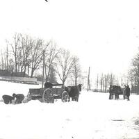
Photographs, maps, and postcards documenting the history of Jericho, NY.
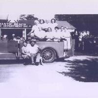
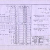
Photographs, maps, and postcards documenting the history of Mastic Beach, NY.
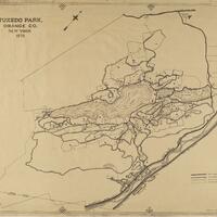
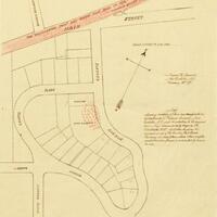
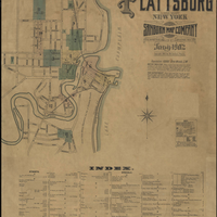
Oversized maps related to the Town of Tuxedo and Orange County.
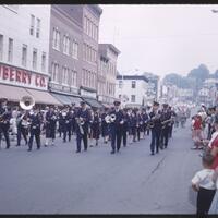
This set of images shows buildings on Main Street in Catskill, NY that are no longer standing.
This collection of maps comes from the MacIntyre Iron Company, which operated at the Tahawus mines near Newcomb, NY.
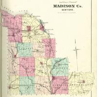
An atlas of Madison County, New York published by Alexander Pomeroy in 1875.
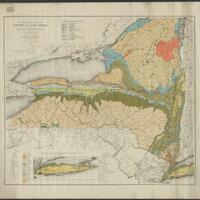
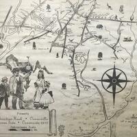
The maps (and, for some, associated documents) in this digital collection represent a portion of the 300+ in the physical Wadsworth collection and cover areas within townships, tracts, and counties in the Genesee Valley region.
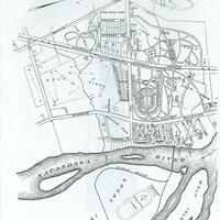
This collection contains a map of Sacandaga Park in 1905.
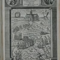
The Medieval and Early Modern Studies Collection includes manuscript leaves, manuscripts, printed book leaves, and books produced mainly in Europe from about 1200 to 1837.
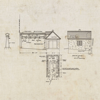
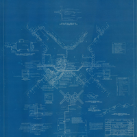
Heart's Delight Farm in Chazy, New York was a state-of-the-art farm in the early 20th century. This collection includes blueprints and maps depicting the farm and its buildings.
Historical maps from Mastic, Mastic Beach, Shirley, Brookhaven, and Moriches communities on Long Island
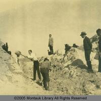
Historic photographs and maps showing land development in Montauk.
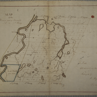
Hand-drawn maps executed by Morgan H.
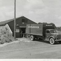
The New York Ordnance Works Collection consists of photographs, maps, and official documents related to the New York Ordnance Works (NYOW), which was in active production during World War II.
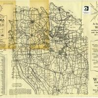
A rural directory for locating farms and agricultural property in Onondaga County and a 1938 Map of Onondaga County.
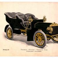
Materials relating to Thomas Flyer automobiles and the New York to Paris Race in the early 20th century.
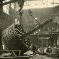
The Niagara Falls Hydraulic Power and Manufacturing Company was the first company to generate hydroelectric power from Niagara Falls in 1882. This collection includes photographs and maps which detail the construction, use, and collapse of this historically important power station.
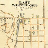
Historical maps of the Northport-East Northport community.
20th century maps relating to places in the Oceanside community.
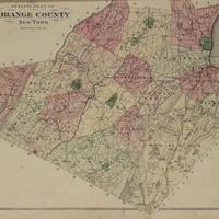
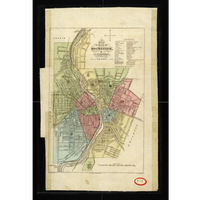
This collection includes the F.W. Beers County Atlas of Orange County (1875) and the A.H. Muller Atlas of Orange County (1903).
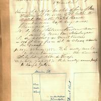
The Pearson Street Books consist of four volumes of notes and sketched maps created by Jonathan Pearson, city historian, about property ownership in the city of Schenectady, New York from the 1660s through the mid-nineteenth century.
Blueprints used in the construction of Pilgrim State Hospital in the 1930’s.
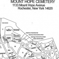
Burial location records and maps for Mount Hope Cemetery in Rochester, New York from the 19th century through to the mid-20th century.
This collection contains regional maps dating from 1827 to the 1980’s. Both individual maps and bound maps, such as plat maps, are included.
1902 Sanborn Map Company Inssurance Map of Plattsburg, Clinton County, New York.