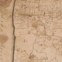
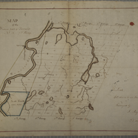
This collection contains the 1740 Cadwallader Colden map - and related indentures - of the 6,000 acres sold to New York's Provincial Governor, Robert Hunter, by Robert Livingston the Elder in 1710 on which to settle the incoming Palatine Germans.
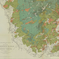
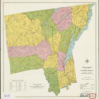
The vast Adirondack Mountains were one of New York State’s last untamed wilderness regions, and historical maps tell the story of how this area was explored, charted, developed and settled from the 1700s through the present day.
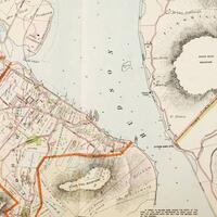
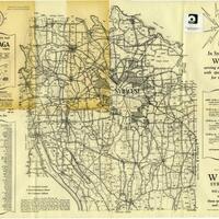
Historic maps detailing land ownership, structures, businesses, and bodies of water from New York City to Troy.
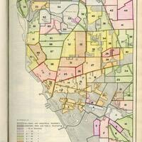
Maps selected from the 1935 Buffalo Municipal Housing Authority Report.
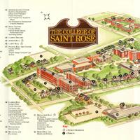
This collection contains maps of the College of Saint Rose campus from the twentieth and twenty-first centuries.
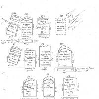
The Colonie New York Cemetery Collection is composed of documents and photographs related to the smaller cemeteries in the Colonie-area.
Maps, lithographs, and directories from the 1876 atlas published by the F. A. Davis Company.
This collection includes the 1875 Beers Atlas of Sullivan County, New York.
Maps, lithographs, and directories from the 1875 Beers atlas of Ulster County.
The Emporium Lumber Company was originally formed in 1892 in Pennsylvania and was dissolved in 1950. The success of the company led to expansion in New York State.
Finch, Pruyn and Company was founded in 1865 when Jeremiah and Daniel Finch, along with Samuel Pruyn, purchased the Glens Falls Company mill in Glens Falls, New York. The company was incorporated in 1900 and paper production began in 1905 and still continues to this day.
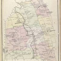
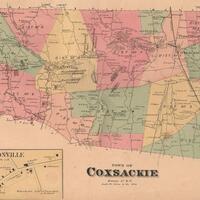
Historical maps of towns located in Greene County, NY.
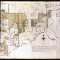
A collection of late 18th century and early 19th century maps, particularly of Western New York and Pennsylvania, created for the Holland Land Company.
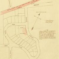
Historical maps showing land purchases and boundaries in the Town of Huntington.
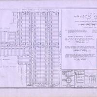
Photographs, maps, and postcards documenting the history of Mastic Beach, NY.
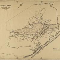
Oversized maps related to the Town of Tuxedo and Orange County.
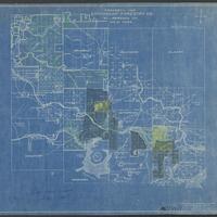
This collection of maps comes from the MacIntyre Iron Company, which operated at the Tahawus mines near Newcomb, NY.
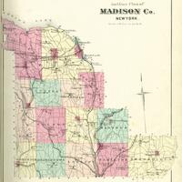
An atlas of Madison County, New York published by Alexander Pomeroy in 1875.
The maps (and, for some, associated documents) in this digital collection represent a portion of the 300+ in the physical Wadsworth collection and cover areas within townships, tracts, and counties in the Genesee Valley region.
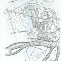
This collection contains a map of Sacandaga Park in 1905.
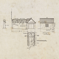
Heart's Delight Farm in Chazy, New York was a state-of-the-art farm in the early 20th century. This collection includes blueprints and maps depicting the farm and its buildings.
Historical maps from Mastic, Mastic Beach, Shirley, Brookhaven, and Moriches communities on Long Island
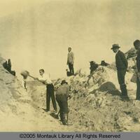
Historic photographs and maps showing land development in Montauk.
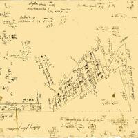
Hand-drawn maps executed by Morgan H.
A rural directory for locating farms and agricultural property in Onondaga County and a 1938 Map of Onondaga County.