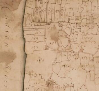
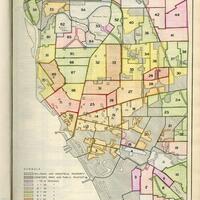
The 1740 Cadwallader Colden map of the 6,000 acres sold to New York’s Provincial Governor, Robert Hunter, by Robert Livingston the Elder in 1710 to settle incoming Palatine Germans on. In 1724, by an order of Governor William Burnet, the 6,000 acres was to be distributed to the Palatines who remained in what was then called East Camp, the Camp, or German Camp, and would eventually be called Germantown.
There were five trustees appointed to distribute the land in 1725: Jacob Sharp, Jacob Shoemaker, Johannes Haener, Johannis Kollman, and Christophell Hagadorn. By 1740/41 when the land was actually distributed, only Haener and Hagadorn still survived. There are 349 lots on the Colden Map. All were granted to individuals among the remaining Palatines.
Former Town Historian Walter V. Miller and Germantown Central School science teacher/ tireless genealogist, Arthur M. Kelly, worked together on compiling a list of known owners of these original lots. Subsequent research by members of the Germantown History Department revealed more original lot owners and sources for most of the Miller/Kelly list. From time to time, previously unknown indentures are found in archives and attics, adding to our knowledge base.
