Collections
Materials documenting the City of Buffalo and Niagara Frontier in 1825.
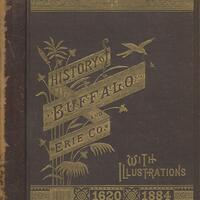
A collection of monographs which detail the history of the Western New York region.
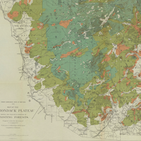
The vast Adirondack Mountains were one of New York State’s last untamed wilderness regions, and historical maps tell the story of how this area was explored, charted, developed and settled from the 1700s through the present day.
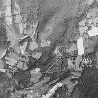
Aerial photographs of the Cary Institute lands and arboretum.
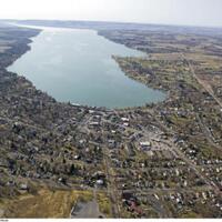
Photos taken from airplanes around Central New York.

Drone photography covering the Village of Aurora with Wells College, the Village of Moravia, the Village of Union Springs, the City of Auburn, as well as neighborhoods and farmlands of Genoa.
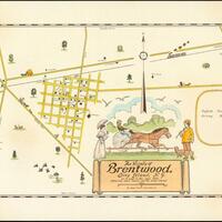
Historical maps of Brentwood and the surrounding area.
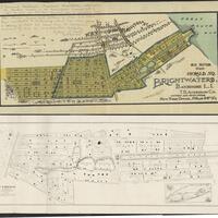
Brightwaters Village throughout the years, early promotion to infrastructure.
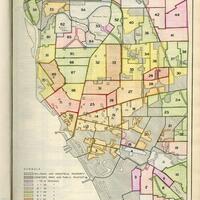
Maps selected from the 1935 Buffalo Municipal Housing Authority Report.
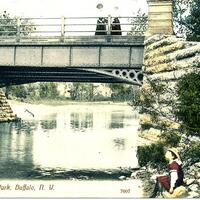
Postcards and stereographs of many Buffalo Olmsted Parks from the late 1800s to early 1900s.
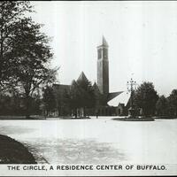
The Buffalo Photograph Collection of lantern slides contains images of cityscapes, street views, events, and architecture in turn-of-the-century Buffalo.
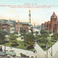
A collection of postcards depicting Buffalo in the early 20th century.
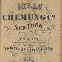
A collection consisting of 2 early atlases of Chemung County (1869,1904) and 2 early atlases of the City of Elmira (1876, 1896). Each image in this collection is a full scale scan of the original items.
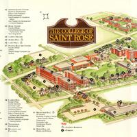
This collection contains maps of the College of Saint Rose campus from the twentieth and twenty-first centuries.
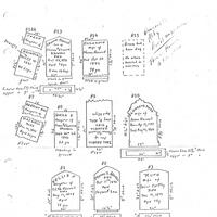
The Colonie New York Cemetery Collection is composed of documents and photographs related to the smaller cemeteries in the Colonie-area.
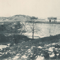
Photo plates, survey maps, and blueprints from the Report to the Aqueduct Commissioners book relative to the East Branch Reservoir in the Town of Southeast.
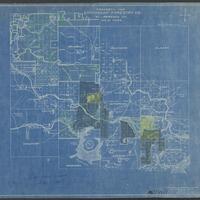
The Emporium Lumber Company was originally formed in 1892 in Pennsylvania and was dissolved in 1950. The success of the company led to expansion in New York State.
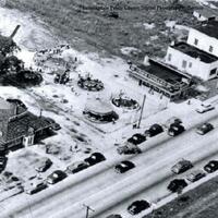
Historic photographs and advertisements of Farmingdale, Long Island.
Finch, Pruyn and Company was founded in 1865 when Jeremiah and Daniel Finch, along with Samuel Pruyn, purchased the Glens Falls Company mill in Glens Falls, New York. The company was incorporated in 1900 and paper production began in 1905 and still continues to this day.
A collection of photographs of Geneva, New York taken by James G. Vail in the late 19th century.
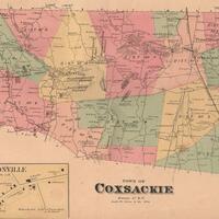
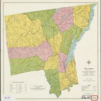
Historical maps of towns located in Greene County, NY.
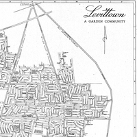
Historical maps of Levittown and the surrounding vicinity.
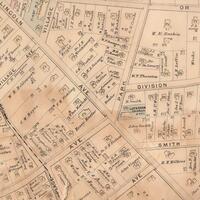
Subdivision, insurance, and local area maps from the late 19th to the mid-20th Centuries.
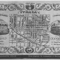
Maps, including Clock System maps, depicting the city of Ithaca and greater Tompkins County.
Photographs, slides, postcards, books, magazines and other miscellany documenting the history of Massapequa.