The Owasco River (also known as the Owasco Outlet) flows north from Owasco Lake, through the city of Auburn, and into the Seneca River. Three separate dams break up the river, all of them in the middle of Auburn.
It was feared that the first dam, known as the State Dam, would collapse. The State Dam controls the levels of Owasco Lake. Threats of downtown Auburn being battered by a 50 foot wall of water are remembered to this day. Fifteen thousand Auburn residents were evacuated, especially residents along the Seneca River and Owasco Outlet. Fortunately, that dam held, and Auburn was spared what could have been much more severe consequences.
The Mill Street Dam, approximately one mile downstream from the State Dam, did wash out during Hurricane Agnes. It was rebuilt a few years later.
Cayuga County was not one of the initial fourteen counties declared an emergency disaster area. However, agencies such as the Civil Defense, Farmers Home Administration, Cayuga County Extension Service, and Agriculture Stabilization and Conservation Office handled hundreds of applications for help, particularly from farmers affected the intense rainfall and flooding. Over $440,000 of relief from the Civil Defense was requested from the City of Auburn alone.
Eventually, after pressure from local legislators, businesses and residents, Cayuga County was declared a disaster area so that individuals and businesses could apply for low-interest loans and relief.
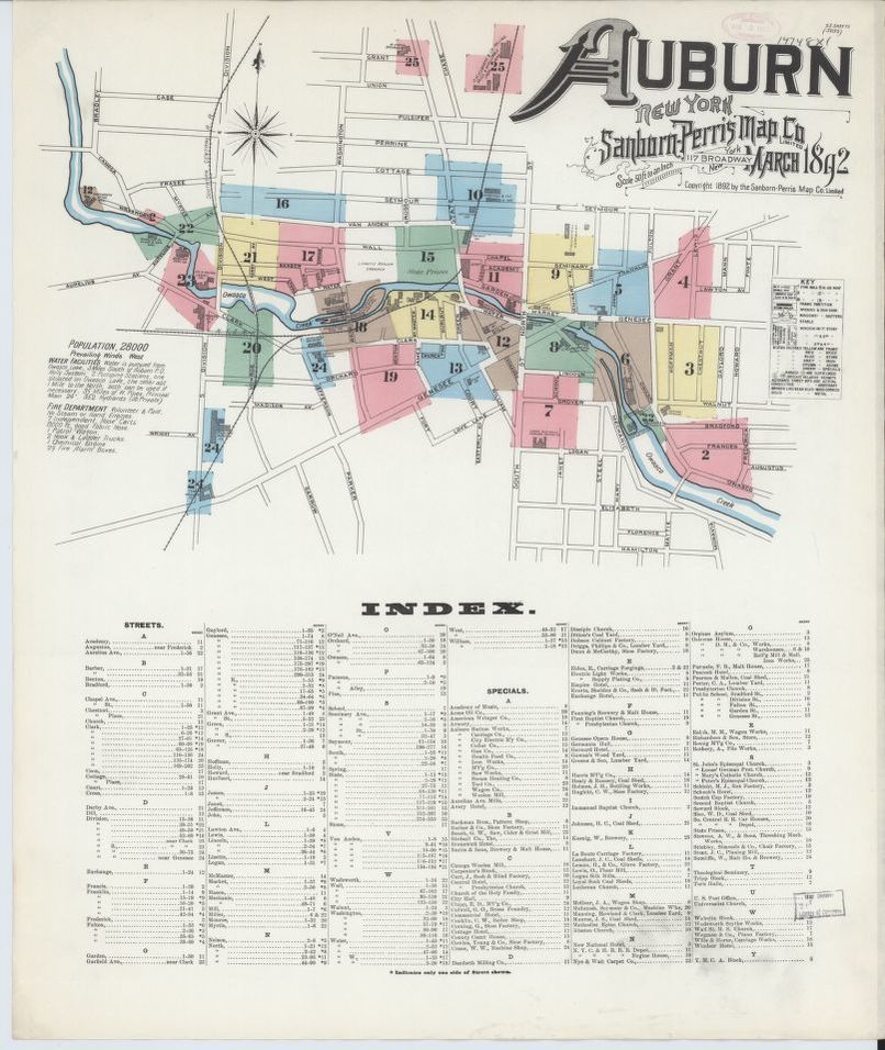
Index of the Sanborn Fire Insurance Map from Auburn, Cayuga County, New York. Courtesy of the Library of Congress Geography and Map Division.
The index map of this Sanborn Fire Insurance Map for Auburn, published in 1892, shows how the city developed around the Owasco River.
The Mill Street Dam was not yet built in 1892, but the location (near the green area for Plate 22) was already in use for hydropower by several commercial interests. The location of the State Dam, also not yet built in 1892, is southeast of this map's coverage.

Map of dams in Auburn. Courtesy of the Cayuga County Historian's Office.
A map from the Cayuga County Historian's Office shows the system of dams and bridges on the Owasco River as it winds through the City of Auburn. The State Dam is the one that showed weakening during the flood of 1972.
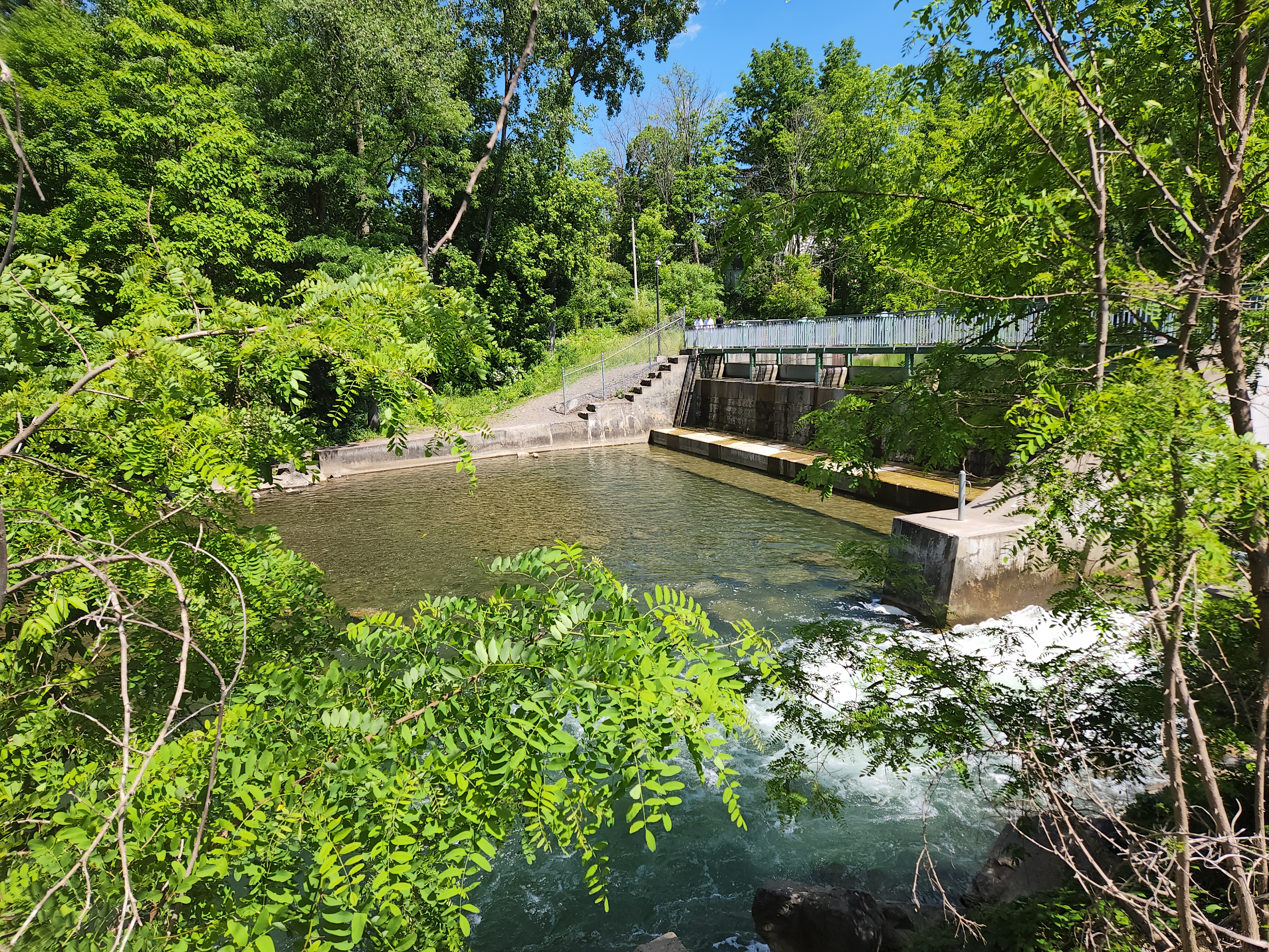
Owasco State Dam, 2022. Courtesy of Claire Lovell.
The original State Dam showed signs of weakening in 1972 but withheld against the pressure of the flooded Owasco Outlet. The dam was rebuilt that year, finished in March of 1973.
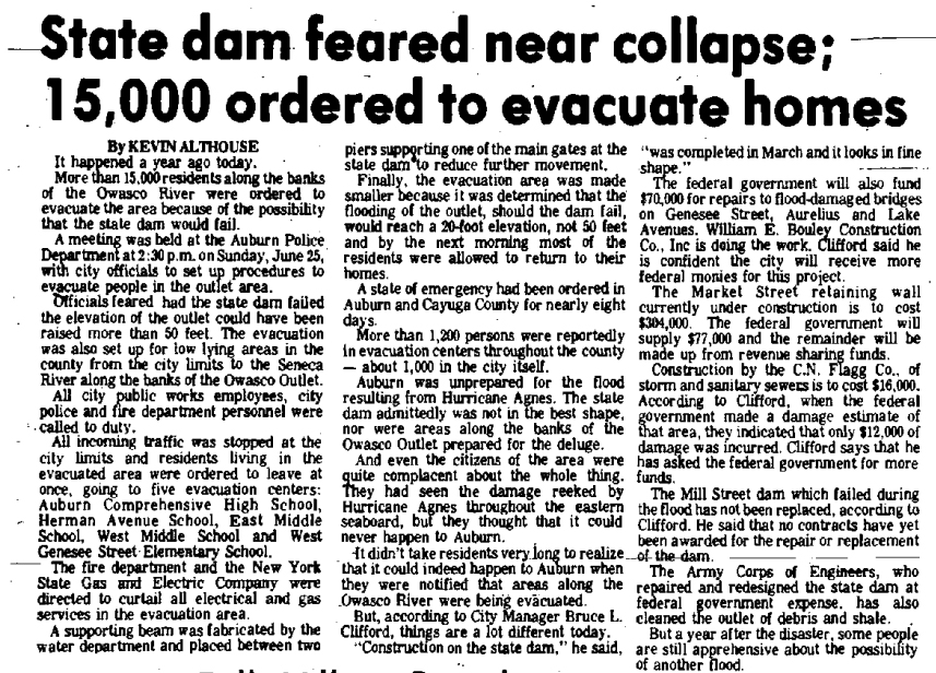
State dam feared near collapse; 15,000 ordered to evacuate homes. The Citizen-Advertiser (Auburn), June 25, 1973, page 17. Courtesy of Old Fulton NY Post Cards.
A year after the flooding in Auburn, the local paper ran this article about the evacuation and the concerns about the dam. It reports that the State Dam was reinforced by the water department with a supporting beam. It also revealed that the initial concerns of a 50 foot wall of water were overblown, and the flooding would only be a 20 foot wall of water if the dam failed.
As of this 1973 article, the Mill Street dam was not yet repaired or replaced.
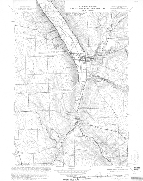
Map showing flood of June 1972 resulting from tropical storm Agnes, Owasco Inlet at Moravia, New York. Courtesy of the U.S. Geological Survey.
Flooding did occur in the lowlands of Cayuga County, such as parts of Moravia, at the head of Owasco Lake.