Rivers abound in south central New York, and where there are rivers, there can be flooding. Historical records of the region include the Ice Flood of 1784, the Great Inundation of 1833, the Big Flood of 1857, and the Tremendous Flood of 1861. There were several Pumpkin Floods, named so because the huge numbers of pumpkins that were uprooted from their fields and washed away, reportedly reaching as far as Wilkes-Barre, Pennsylvania, in 1817.
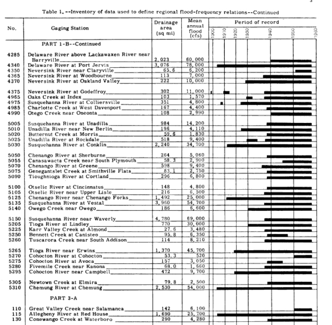
Inventory of data used to define regional flood-frequency relations. Courtesy of the U.S. Geological Survey and Google Books.
This 1961 report maps out the gaging stations in New York State and includes this table of average flooding, listed in cubic feet per second (cfs). The Tioga River near Erwin in Steuben County, the Chemung River in Chemung County, and the Susquehanna River in several counties are shown to have very high flood averages.
This data was used to predict the magnitude and frequency of flooding around the state with an eye toward building dams and other flood control measures.