Water had already begun spilling over the dikes in the nearby town of Portersfield on the morning of June 22 when William O. Smith, Olean’s mayor, announced that the National Weather Service projected that the river would rise 24 feet by the next day. One third of the population of Olean was ordered to evacuate, and the downtown district was already under water.
Fortunately, the National Weather Service had overestimated the amount of flooding Olean was to experience and the preemptive evacuation prevented any injuries. The flooding, while damaging, was modest compared to what other communities suffered.
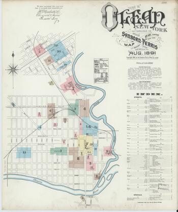
Sanborn Fire Insurance Map from Olean, Cattaraugus County, New York. Courtesy of the Library of Congress Geography and Map Division.
This 1891 Sanborn map of Olean shows how close the Allegheny River and its tributary, the Olean Creek, were to the development of Olean.
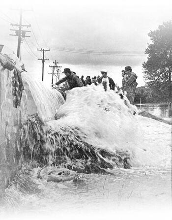
Water comes rushing over the concrete barrier of a dike on Front Street in Olean. Courtesy of Olean Times Herald.
This photograph was part of an article marking the 40th anniversary of the flood in 2012. The Olean Times Herald noted that the newspaper had been forced to suspend publication on June 23 and June 24, 1972, for the first time in the paper's 112 year history, because their printing press on Norton Drive was part of the evacuation area.
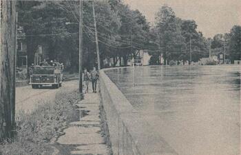
This concrete retaining wall held back Olean Creek.
Olean Retaining Wall During Hurricane Agnes from Flood: The Southern Tier's June 1972 Disaster: A Pictorial Review (Hornell, NY: 1972). Courtesy of the Internet Archive and OpenValley.
This is a calmer photo of the same concrete retaining wall on Front Street in Olean as seen above.
Had Olean Creek crested over this wall, the North Olean and the Boardmanville areas would have flooded.


