Hornell and nearby communities like Addison and Canisteo were largely spared destruction from flooding in 1972 because of two large dams: the Arkport Dam and the Almond Dam. Those dams had been constructed after the deadly 1935 flood.

Sanborn Fire Insurance Map from Hornell, Steuben County, New York. Courtesy of the Library of Congress Geography and Map Division.
As was the case with so many communities around south central New York, Hornell (once known as Hornellsville) was built at the nexus of waterways: the Canisteo River, the Canacadea Creek and Crosby Creek. Crosby Creek and Canacadea Creek flow into the Canisteo River, which in turn flows into the Chemung River and then ultimately, the Susquehanna River.
These waterways flooded Hornell and the community suffered spectacular damage in 1935.

Arkport Dam Fact Sheet. Courtesy of the US Army Corps of Engineers.
The Arkport Dam was the first dam built by the U.S. Army Corps of Engineers, having been authorized by the Flood Control Act of June 22, 1936 in swift response to the 1935 flood. The dam is normally a "dry dam," except after heavy rains. It's able to hold back 2.6 billion gallons of water from the Canisteo River watershed.
The Almond Dam was also authorized in 1936, but was not completed until 1949, having been delayed by World War II. The construction of Almond Dam created Almond Lake, a reservoir that can handle 4.8 billion gallons of water from the Canisteo River watershed.
Almond Lake was at nearly 94% capacity in June of 1972 and the reservoir created by Arkport Dam was at 100% capacity, but the dams held. The dams kept the Canisteo River from flooding the downstream communities, protecting Hornell and neighboring Canisteo.
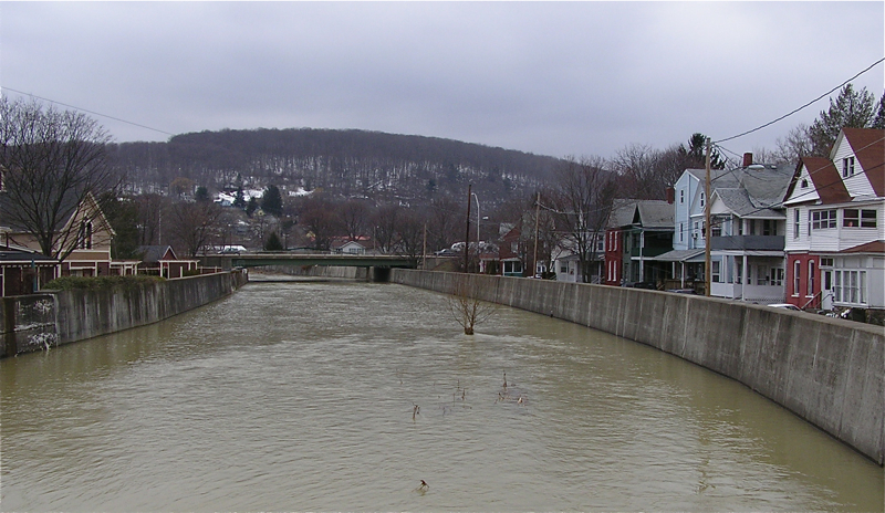
Canacadea Creek in Hornell, New York. Courtesy of Marduk on Wikimedia Commons.
As is evident in this contemporary (2011) photo, the Canacadea Creek still bisects Hornell. However, the Arkport Dam, Almond Dam, and other flood control measures from the 1930s and 1940s were largely able to withstand the ferocity of Agnes' flooding in 1972.
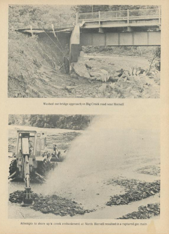
Flood: The Southern Tier's June 1972 Disaster: A Pictorial Review. by W.H. Greenhow Co. Courtesy of the Internet Archive.
Despite effective flood control measures, there was still damage around Hornell, Addison, and Canisteo. These two images speak to the extent of infrastructure damage along the river and its tributaries. In the top image, the support near a bridge over Big Creek is washed out.
The image on the bottom shows a gas line that was inadvertently ruptured by construction machinery as workers tried to reinforce the creek embankment. Gas service throughout the Southern Tier was interrupted by the flood, as was potable water, telephone service, and electricity.
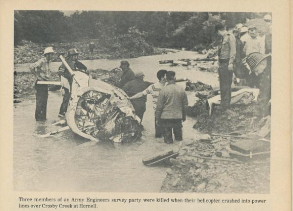
Flood: The Southern Tier's June 1972 Disaster: A Pictorial Review. by W.H. Greenhow Co. Courtesy of the Internet Archive.
Of the 24 fatalities in New York, three were due to a tragic helicopter crash. Three US Army Corps of Engineers members were surveying damage when their helicopter came into contact with power lines over Crosby Creek.