Known as “The Finger Lakes Flood,” major flooding affected much of central New York and northern Pennsylvania in July 1935. Devastation was evident in a wide region between the Catskills Mountains and Hornell, from the Pennsylvania border to the Mohawk Valley.
In Schuyler and Steuben Counties, one source reported twelve inches of rain fell on the upper Meads Creek watershed in just nine hours.
The damage was in the hundreds of millions of dollars at the time ($100 million in 1935 is $2 billion in 2022 dollars) and over 40 people lost their lives.
The Albany Evening News summarized the flood in their yearly review on December 26, 1935: "As headlines that flashed across front pages in 1935 recede into memory with the passing year, one New York State news story stands out above all others -- the disastrous July flood in the Southern Tier. Greatest news event of the year, it was also one of the biggest stories in Empire State history."
After the flooding, the US Army Corps of Engineers raised the dikes in Corning by two feet, thinking this would be sufficient to prevent any future disaster.
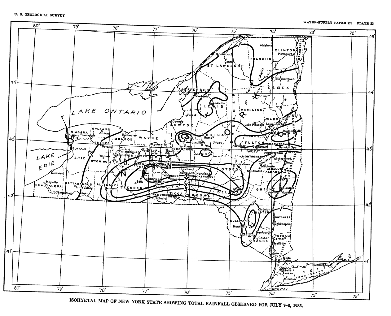
Isohyetal Map of New York State Showing Total Rainfall Observed for July 7-8, 1935. Courtesy of the U.S. Geological Survey.
This map shows the rainfall that led to the flood of 1935 as recorded by the United States Weather Bureau at their gaging stations.
The amount of rainfall over 24 hours was 50-70% higher than previous records at most places. In Ithaca, for example, where precipitation had been measured for 77 years by 1935, 7.90 inches fell between July 7 and July 8, where the previous record had been 4.7 inches.
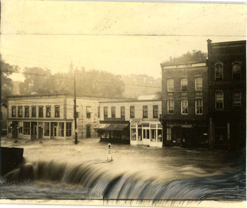
Intersection Rt 96 (Main St.) and Union St in Trumansburg covered in flood water. Courtesy of the History Center in Tompkins County.
Trumansburg Creek flows under Main Street in downtown Trumansburg in Tompkins County. Here, the creek has risen to a catastrophic height.
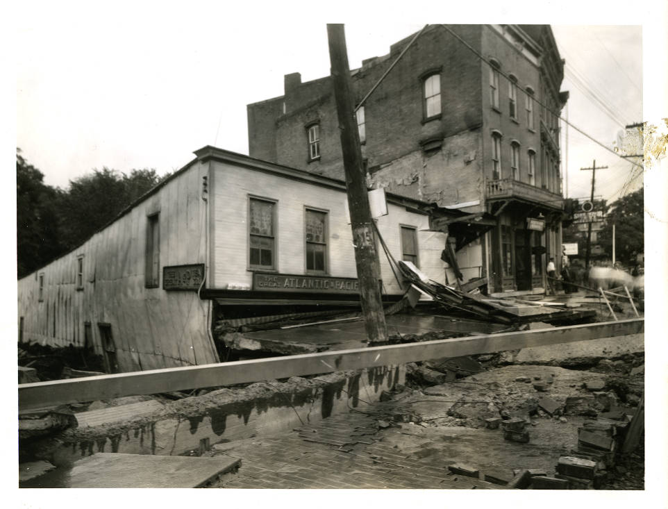
A+P Grocery Store on Main St in Trumansburg. Courtesy of the History Center in Tompkins County.
View of that same block of Main Street, after the water returned to a normal level. The flooding undermined the foundations of this A&P, which had been built over the creek. It completely collapsed and was not rebuilt.
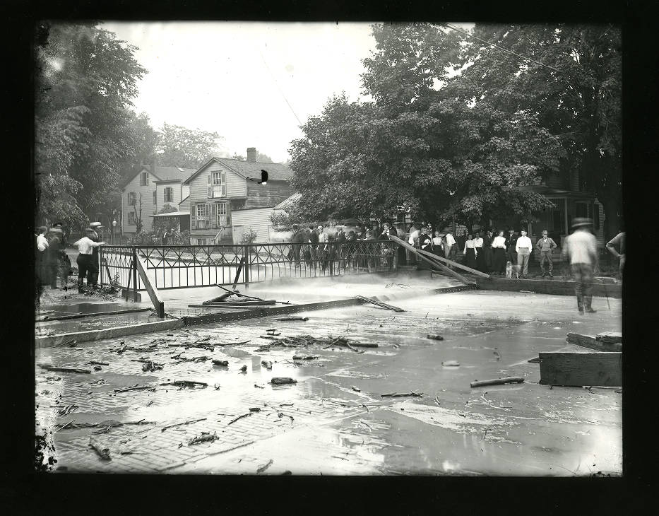
Flooded intersection in Groton, 1935. Courtesy of the History Center in Tompkins County.
Groton, another town in Tompkins County, was also severely flooded in 1935. This photo shows the Village of Groton under water.
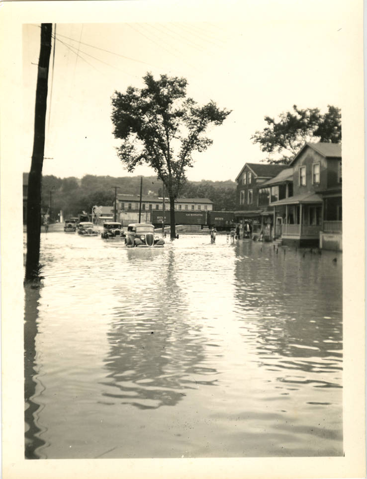
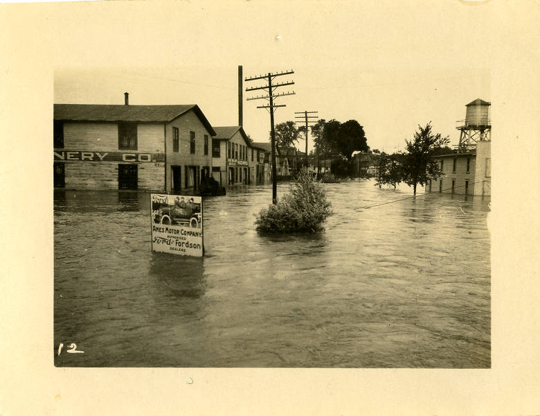
West Buffalo Street in Ithaca, flooded. Courtesy of the History Center in Tompkins County.
This portion of downtown Ithaca and the Lackawanna railroad tracks behind it were all under water.
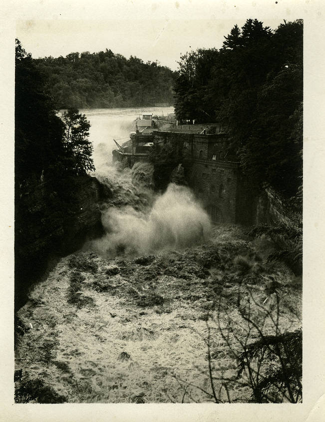
Below Beebe Lake's Triphammer Dam from East Ave bridge. Courtesy of the History Center in Tompkins County.
The water flowed in raging torrents over Triphammer Dam, below Beebe Lake in Ithaca. The photo is taken from the East Avenue Bridge.
People alongside an overflowing creek in a residential neighborhood (possibly Fall Creek). Courtesy of the History Center in Tompkins County.
Creeks in Ithaca overflowed onto residential streets in 1935 after days of heavy rainfall.