Much of New York’s Southern Tier region encompasses the traditional homeland of the Haudenosaunee (Hodinǫ̱hsǫ́:nih) Confederacy, comprising the Mohawk (Kanien'kehá:ka), Oneida (Onʌyota'a:ka), Onondaga (Onoñda'géga'), Cayuga (Gayogo̱hó:nǫʔ), Seneca (Onöndowa’ga:'), and Tuscarora (Ska:rù:rę') Nations.
The many rivers of the region, including the Chemung and its tributaries, provided a means of sustenance, transportation, trade, and communication.
During the period of European encroachment and displacement, the Haudenosaunee provided land to other indigenous nations, including the Tutelo and Saponi peoples.
In 1779, General George Washington ordered General John Sullivan to carry out a scorched-earth campaign against the Haudenosaunee people, especially the Senecas, Cayugas, and Onondagas. Known as the Sullivan-Clinton Campaign of 1779, thousands of Haudenosaunee people as well as the Tutelo, Saponi, and other indigenous people on Haudenosaunee territory were forced to flee, killed, or taken prisoner. Their villages, towns, crops and winter stores were destroyed.
After the war, the newly formed American government gifted land appropriated from the Haudenosaunee and other indigenous nations to Revolutionary War veterans in land grants. This led to an influx of white settlements beginning in the late 18th Century, forming predominantly along the many rivers in the region, including the Chemung.
The Chemung River is formed just west of Corning in Steuben County by the merger of the Cohocton, Tioga, and Canisteo Rivers flowing in from the west. It flows southeast through Corning and then Elmira, in Chemung County, and enters Pennsylvania at the town of Waverly. There, it merges with the Susquehanna and flows south to eventually empty into the Chesapeake Bay.
It was the Chemung River that flooded Corning and its neighboring communities like Riverside, Painted Post, and Gang Mills in June of 1972. These were among the worst affected communities.
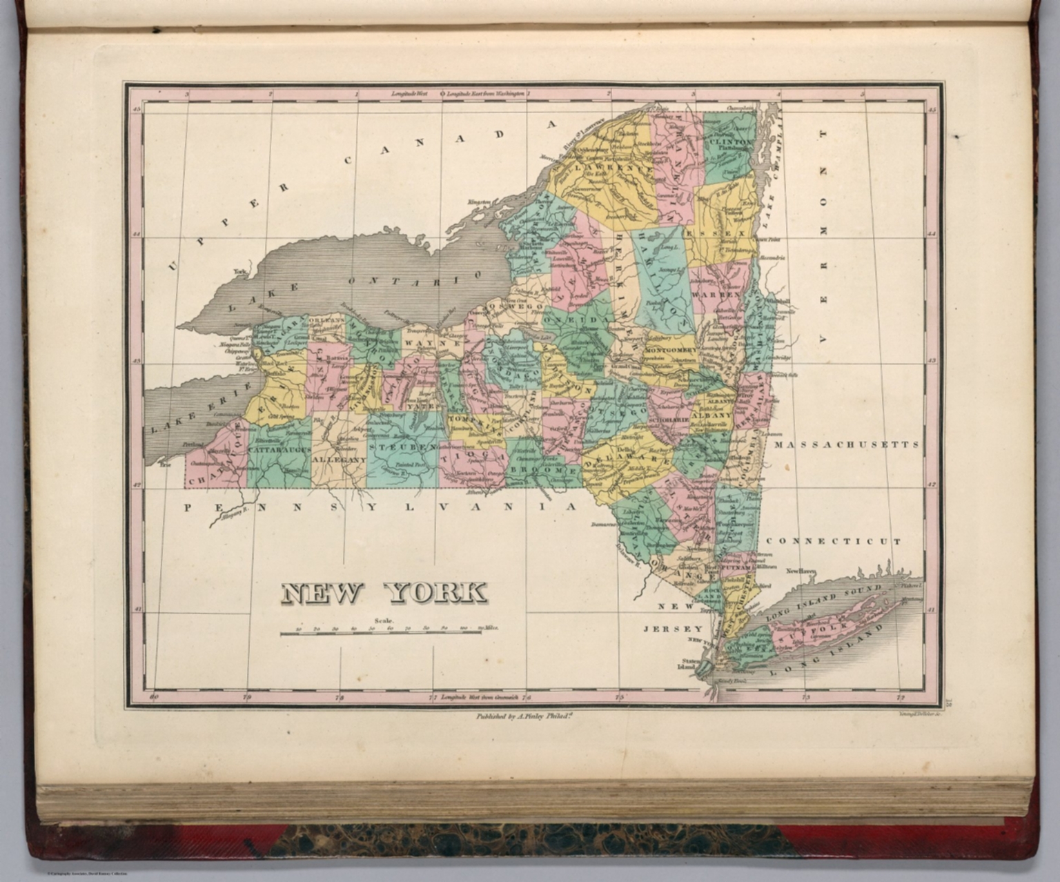
New York. Young & Delleker Sc. Published by A. Finley, Philada. (to accompany) A New General Atlas Comprising a Complete Set of Maps, representing the Grand Divisions Of The Globe ... Philadelphia: Published by Anthony Finley. 1827. Courtesy of the David Rumsey Map Collection.
This map of New York State was published within fifty years of the Sullivan-Clinton Campaign of 1779. Nascent county lines are drawn in green, and the river network is labeled. The Erie Canal and significant railways are also indicated.

General view of the cut - Erie Railway, Corning Side Hill Cut, Chemung River, Corning, Steuben County, NY. Courtesy of the Library of Congress Prints and Photographs Division.
This photograph of the Chemung River as it runs through Corning in Steuben County shows the geography of the valley, where buildings, railways, and roads are next to the river. This photograph, part of the Historic American Engineering Record, was taken within a few years before the flooding of 1972.