Until the construction of the Erie Canal, New Orleans had nearly exclusive access to trade with the rich interior of North America because of its location on the Mississippi River. Beginning in the seventeenth century during French, Dutch, and then British competition for the fur trade in North America, people realized that New York City, with its deep and protected harbor and access to the interior via the Hudson River, was strategically situated for trade with Europe. As early as 1724, Cadwallader Colden, surveyor general and later colonial governor of the Province of New York, prepared a report for the governor describing the natural "water courses and carrying places" (portages) between Albany and Montreal, Canada, and between Albany and Cataraqui Lake, now known as Lake Ontario. It took another one hundred years before the New York Corresponding Association for the Promotion of Internal Improvements was organized to advance support for building a canal across New York State—a project they envisioned as the starting point for a cross-country navigation system of waterways bridging Lake Erie with the Atlantic Ocean, the Mississippi River, and the western states of Michigan and Illinois.
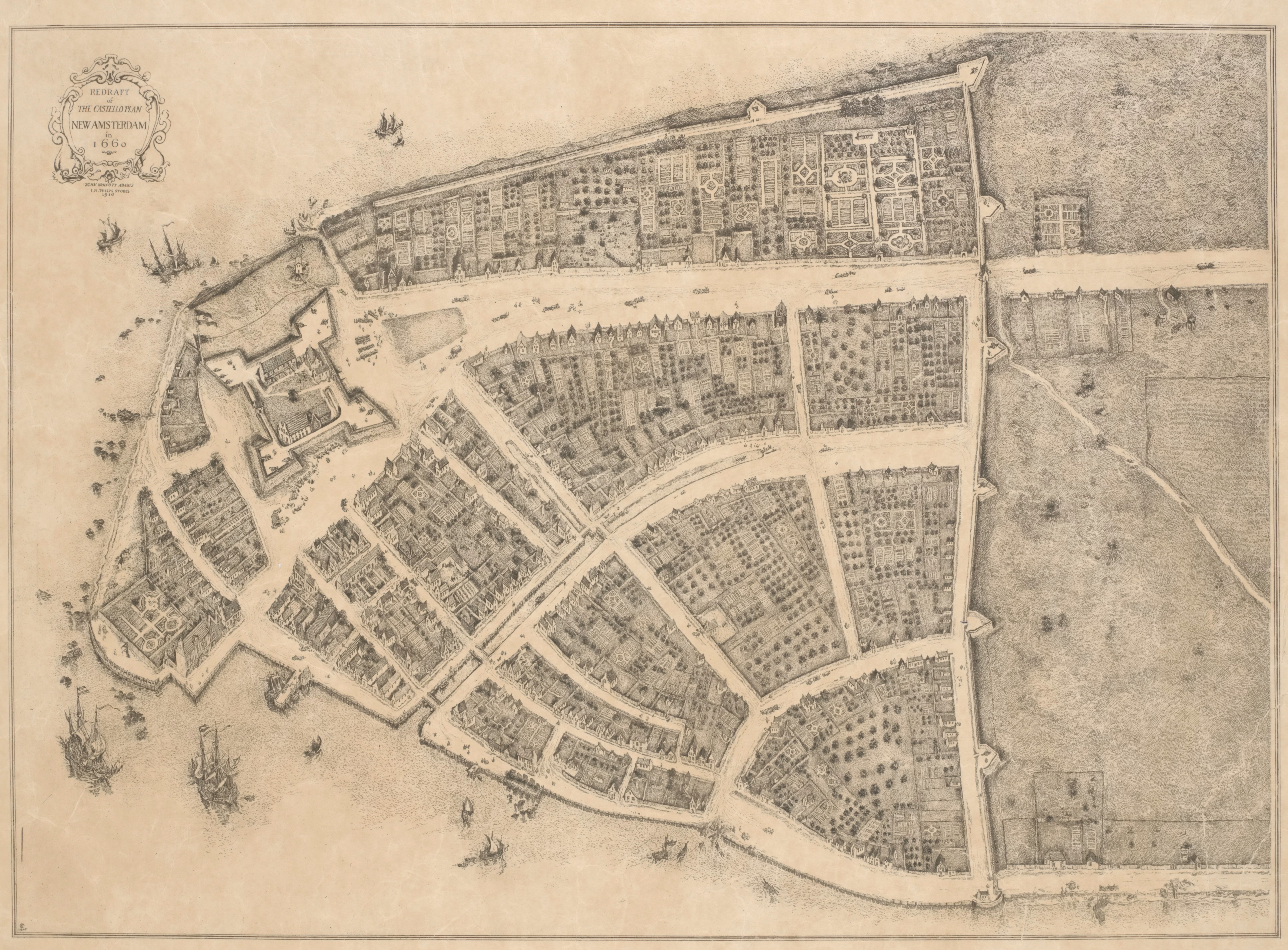
Castello Plan of New Amsterdam. Image Courtesy of NYPL Digital Collections.
This is an excerpt from an 1821 publication of the New York Corresponding Association for the Promotion of Internal Improvements, which provided the impetus for exploring a canal route connecting the western and northern lakes with the Atlantic Ocean. Courtesy of University of Minnesota via HathiTrust.