After America established its independence, the federal government needed a system for surveying, measuring, and distributing lands it now owned, and the Land Ordinance of 1785 was approved by the Confederation Congress. In 1802, a syndicate of Dutch investors, known as the Holland Land Company, purchased an enormous tract of land in Western New York, hoping, like many post-revolutionary speculators, to sell their land for a quick profit. However, the company was forced to make substantial investments in roads and canals to attract buyers, including granting over 100,000 acres of their western lands for the canal route. The final tracts were not sold until 1837 after the Erie Canal was completed.
In 1810, Simeon De Witt, the Surveyor General for the State of New York who was responsible for supervising the division of the western part of the state into townships, was also appointed to the Erie Canal Commission. He was joined in 1816 by land surveyor Joseph Ellicott, who was also working for the Holland Land Company. Ellicott, along with his brothers, Andrew and Benjamin, and William Peacock and James Geddes were instrumental in mapping out the best route across the state for the Canal.
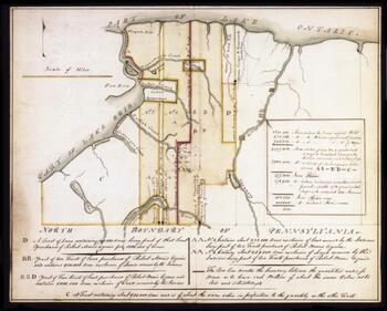
This map shows the Genesee lands belonging to the Holland Land Company in 1798, as well as the Seneca Nation Reservation and major waterways in Western New York. Courtesy of SUNY Fredonia via Western New York Library Resources Council and Empire State Digital Network.
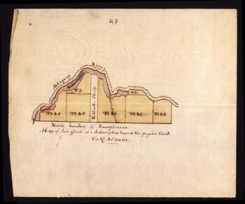
This map shows the strip of land on the border of New York and Pennsylvania that was offered by the Holland Land Company in 1812 as a subscription towards the construction of the proposed canal. Courtesy of SUNY Fredonia via Western New York Library Resources Council and Empire State Digital Network.
The survey chain was the basic method used by land surveyors for measuring distance from about the mid-seventeenth to late nineteenth century. Courtesy of Smithsonian National Museum of American History.

