Collections
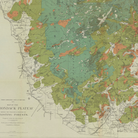
The vast Adirondack Mountains were one of New York State’s last untamed wilderness regions, and historical maps tell the story of how this area was explored, charted, developed and settled from the 1700s through the present day.
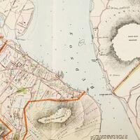
Historic maps detailing land ownership, structures, businesses, and bodies of water from New York City to Troy.
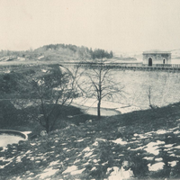
Photo plates, survey maps, and blueprints from the Report to the Aqueduct Commissioners book relative to the East Branch Reservoir in the Town of Southeast.