Western New York County Atlases

Cover Image:
Western New York County Atlases
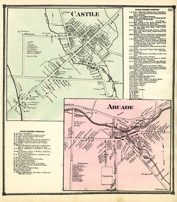
Castile and Arcade, New York - Image Source

Collection Facts

Extent:
313
Dates of Original:
1866 - 1869; 1881

Historical Context

This collection of over 300 images is derived from several atlases found in the Local History Collection at SUNY Fredonia's Reed Library. The atlases cover the following counties: Cattaraugus, Chautauqua, Genesee, and Wyoming for the time period 1866-1881. The atlases, produced by S.N. and D.G. Beers and Assistants (known as "Beers Atlases") include a wide range of information about the demographic and geographic features of the counties, their towns and villages, including travel distances between points, town histories, geographic landmarks, images of well-known citizens as well as images and locations of farms, mills, schools, businesses, religious establishments, private residences and more. This collection was digitized subsequent to the digitization of the earlier Holland Land Company Maps also held by Reed Library. When brought together, these two collections contextualize the rapid growth and expansion of communities, wealth, and infrastructure in Western New York, from the earliest European land settlements beginning in the 1790s through the post-Civil War industrialization that characterized the region in the late nineteenth century.

Scope of Collection

The Western New York County Atlases collection includes: maps of the region, town histories, census information, biographies of prominent citizens, illustrations of notable buildings and residences, as well as illustrated town and city scenes. The collection dates from the 1860s and early 1880s.