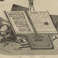
Collections
![19th Century Monographs on the History of Western New York](/sites/default/files/styles/browse_thumbnail/public/content/collection/covers/VVN001.jpeg?itok=QHv__YOd)
A collection of monographs which detail the history of the Western New York region.
![Combination Atlas Map of Rockland County, New York](/sites/default/files/styles/browse_thumbnail/public/content/collection/covers/Map.jpg?itok=ug208cCW)
Maps, lithographs, and directories from the 1876 atlas published by the F. A. Davis Company.
![County Atlas of Sullivan New York](/sites/default/files/styles/browse_thumbnail/public/content/collection/covers/VGN001.jpg?itok=cm1Dd0Ko)
This collection includes the 1875 Beers Atlas of Sullivan County, New York.
![County Atlas of Ulster New York](/sites/default/files/styles/browse_thumbnail/public/content/collection/covers/square.jpg?itok=l_GYBQoP)
Maps, lithographs, and directories from the 1875 Beers atlas of Ulster County.
![Madison County Atlases](/sites/default/files/styles/browse_thumbnail/public/content/collection/covers/SRR014_5_0.jpeg?itok=kXYbg9ix)
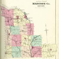
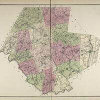
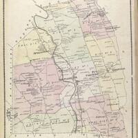
An atlas of Madison County, New York published by Alexander Pomeroy in 1875.
![Pearson Street Books](/sites/default/files/styles/browse_thumbnail/public/content/collection/covers/SCHS_Pearson.jpg?itok=Mn7fq0mf)
The Pearson Street Books consist of four volumes of notes and sketched maps created by Jonathan Pearson, city historian, about property ownership in the city of Schenectady, New York from the 1660s through the mid-nineteenth century.