Collections
![Heermance Memorial Library Digital Collection](/sites/default/files/styles/browse_thumbnail/public/content/collection/covers/coxsackie%2520square.jpg?itok=smAXOX0P)
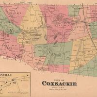
Historical maps of towns located in Greene County, NY.
![Historical Maps of Ithaca and Tompkins County](/sites/default/files/styles/browse_thumbnail/public/content/collection/covers/Historcal%2520Maps%2520of%2520Ithaca%2520and%2520Tompkins%2520County.jpg?itok=lQVUJEzA)
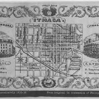
Maps, including Clock System maps, depicting the city of Ithaca and greater Tompkins County.
![Holland Land Company Archives](/sites/default/files/styles/browse_thumbnail/public/content/collection/covers/Archives_of_the_Holland_Land_Company_representatives_in_the_United_States_of_America_document_group_478.jpg?itok=pZIUUkb1)
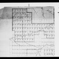
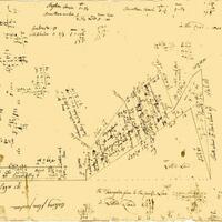
A collection of 20 digitized reels of microfilmed primary source materials relating to the history and early years of the Holland Land Company, with a focus on materials detailing the history and development of Western New York.
![Holland Land Company Maps](/sites/default/files/styles/browse_thumbnail/public/content/collection/covers/XFM001.jpeg?itok=JpdmEV0z)
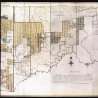
A collection of late 18th century and early 19th century maps, particularly of Western New York and Pennsylvania, created for the Holland Land Company.
![Huntington Historical Maps](/sites/default/files/styles/browse_thumbnail/public/content/collection/covers/ZRR165.jpg?itok=5B0BSla8)
Historical maps showing land purchases and boundaries in the Town of Huntington.