South Buffalo neighborhoods began with the digging and completion of the Erie Canal, extending from downtown Buffalo to West Seneca on the east, Lake Erie on the west and Lackawanna on the south. The Old First Ward, considered the cradle of South Buffalo, was home to canal workers and grain scoopers. The community was a desperately poor overcrowded slum of the early 1800’s. All other South Buffalo neighborhoods grew outward from the First Ward.
Most of what is now South Buffalo was largely part of the Buffalo Creek Reservation, put aside for the Seneca Nation at the time of the Holland Land purchase. The Compromise Treaty of 1842 sent the Seneca south to the Cattaraugus Reservation and opened the area for urban development.
Those who have visited the outer harbor’s Times Beach Nature Preserve may be surprised to learn that for about a half-century (1860s–1910s) it was a well-established shantytown. The raucous squatter’s neighborhood was known as the “Island,” the “Beach,” the “Seawall Strip,” or its site was simply described as “at the foot of Michigan.” Its location spanned from Buffalo’s lighthouse to today’s Wilkeson Pointe and sat between the City Ship Canal and Lake Erie.
A collection of simple, gable-roof, raised frame homes were interspersed along the beach amongst grain elevators. The Seawall included a small schoolhouse, Our Lady of Mercy Church, general stores, clubs, taverns, and restaurants. Most Island inhabitants worked on the waterfront as sailors, ship carpenters, lake captains, freight handlers, grain elevator operators, grain scoopers, dock workers, teamsters, saloon keepers, and women often worked as dress makers or packers. These blue collar families were predominantly of Irish descent, but Germans, Portuguese, Yankees, and other groups were also residents. Eventually, Seawall inhabitants were evicted from the Island to make way for industry and a highway. Many “Beachers” were evicted in 1917, but it wasn’t until the 1930s that all of its residents left the area.
South Buffalo today, from its working-class neighborhoods to the grandeur of its Olmsted parks, is populated by people of many nationalities, but it is designated an official Irish Heritage District due to its historic association with Irish immigrants. Cultural pursuits at the Buffalo Irish Center, pubs and traditional music can always be enjoyed. The often-quiet residential areas of the First Ward and The Valley once again hosts raucous crowds for the annual St. Patrick’s Day parade, one of the oldest in the region.
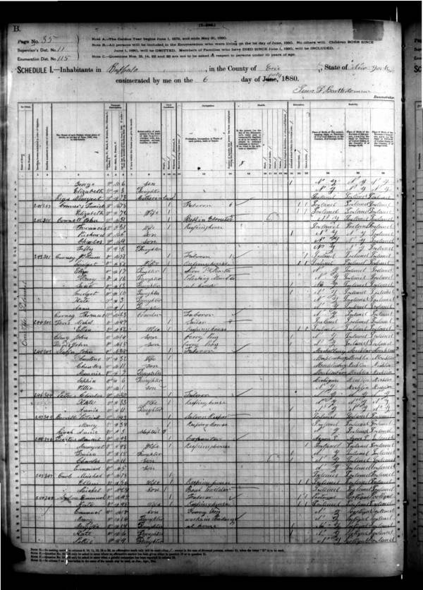
A glimpse of settlers living on the Seawall from the 1880 U.S. Federal Census. The left margin shows their place of residence as "On the Island."
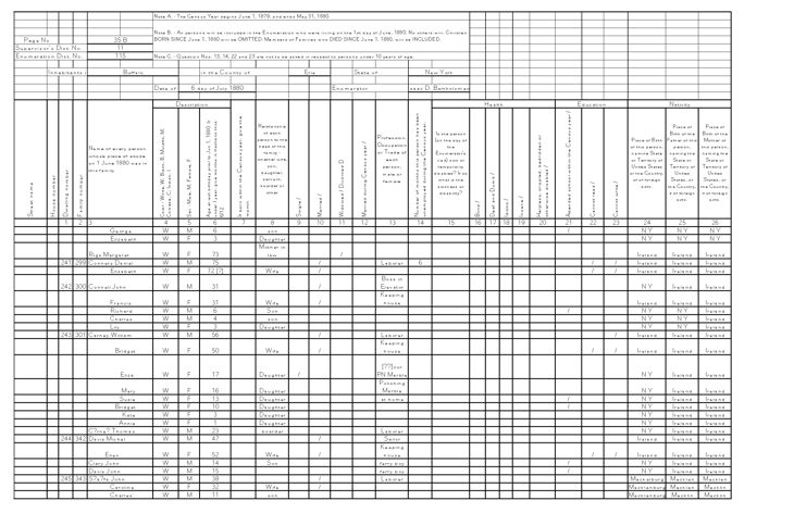
Transcription of some settlers living on the Island in the 1880 census.
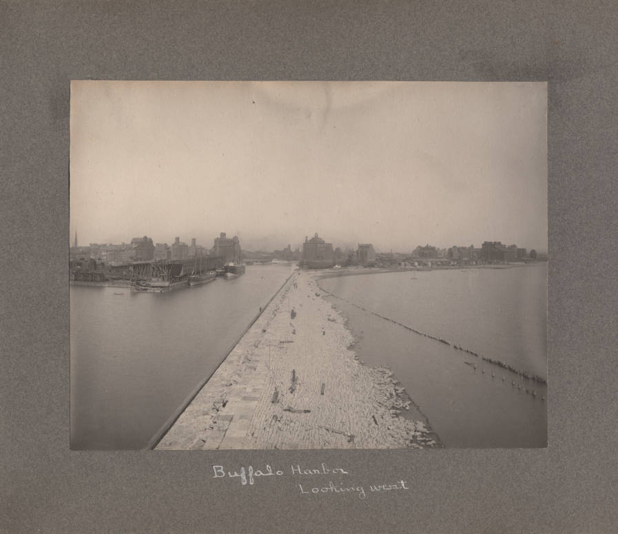
This circa 1899 image of Buffalo Harbor shows the "Island" shantytown on the right of the photograph.

Mann's Map of Buffalo Harbor and "The Island," 1888.
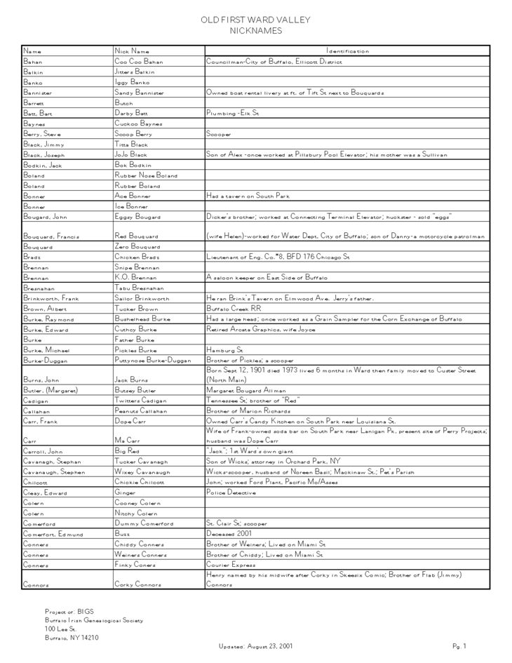
List of Buffalo Irish nicknames compiled by the Buffalo Irish Genealogical Society.
Remembering the Old First Ward.